2025 – Summer Teaser
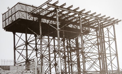
This was a Black Country landmark for fifty years. Name the location and try to discover the surprising story.
Send an email if you have any ideas.
The SLHS 2025 / 2026 Programme
Coming soon(ish)! Watch this space ...
Sedgley Heritage Trails
During 2019 two trails were researched covering nearly forty places of interest within easy walking distance of Sedgley Bull Ring.
A leaflet was then prepared by Sedgley Evening Townswomen's Guild with support from Sedgley People's Archive and Sedgley Local History Society. There was specialist help and advice from Dudley MBC who printed the final version.
The trails can be followed using the street map alongside notes and pictures.
Follow this link to download a copy of the leaflet and enjoy the trails.
Sedgley Local History Society [SLHS]
Sedgley Local History Society [SLHS] is a Black Country group based in the village of Sedgley, which is situated at the northern tip of Dudley Metropolitan Borough and just 3 miles south of the centre of Wolverhampton.
Here, the heritage of the Manor of Sedgley, in south Staffordshire, is focused through its nine villages - Sedgley, Gospel End, Cotwall End, Upper Gornal, Lower Gornal, Woodsetton, Coseley, Ettingshall and Brierley. A history of people, places and events.
Please contact
us if you have any comments, suggestions, contributions or
questions.
Please note that genealogy isn't a prime interest of SLHS - it's a huge specialist area in its own right. We provide a list of useful sites on our genealogy links page that will help you to begin your research, however if you have a specific query drop us a line!
2025 – Spring Teaser Answer
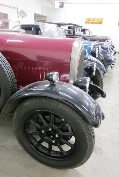
The car in the the foreground was built by one of the most famous Black Country firms.
We asked if you could can name the manufacturer.
A. Harper, Sons & Bean Ltd was located in Hurst Lane, Tipton a quarter of a mile outside the Sedgley Manor boundary. Here Bean chassis were assembled and engines fitted on an electrically powered assembly line - the first British car to be made on a moving track.
The skeleton cars were tested on an adjacent half mile circuit before being driven 2 miles to the Waddam's Pool factory in Dudley for bodies to be fitted.
The 1925 Bean 14 Tourer glimpsed in the picture can be seen at the Black Country Living Museum. The maximum speed was 50mph with a comfortable cruising speed of 30 to 35mph.
Sadly the spotlight only shone on Bean cars for a decade from 1919 to 1929 although the name lingered on as Bean Industries and then Bean Engineering until final closure in 1994.